Pennine Way 1989
Was it really that long ago? Well, back then I had more free time and spent much of it hiking. It was the summer of the first year of my PhD.
If pubs seem to figure prominantly amongst the pictures, then ask yourself what do you do with yourself at the end of the day when you're tired out (to put it mildly) but it's still only 6 or 7 o'clock? When you're backpacking, you can't exactly put your slippers on and sit down in a comfy chair and watch the telly. Lying in a sleeping bag with a pocket radio more like it. Well, given the option of a pint and a warm pub, I know which one I'd choose every time.
If the pictures seem a bit dark, that might be for 2 reasons. I hadn't long bought my camera when I did the walk, and I only took my photochromic specs with me. Since I can't see without the glasses on, I had to take the pictures effectively wearing sunglasses. On top of that, it really wasn't very sunny. I only remember it raining once, but what do you expect in England in the middle of summer? Sunshine? In any case, with the aid of a bit of digital tweaking, the pictures here are a bit brighter than the prints that I have.
The daily descriptions were written on the spot, on the back of 7 sheets of A4 that I'd prepared with a description of the route (and estimates of the time each stage should take). I've kept some of the mis-spellings (and perhaps added some typos). The *s aren't in my original notes either.
If it seems as though I was always in a hurry, counting the seconds and 'belting along', then remember that 'belting along' when you are carrying a backpacking rucsac (16kg or 35lbs) means 5km/h or 3mph at the absolute maximum. Even though I was carrying a tent and water and food, I didn't particularly want to be out on the fells come nightfall. Frequently I spent 8 to 10 hours a day walking, and on several of the days finished at dusk (which in the North of England in August is quite late in the evening). To do the whole 270miles (435km) in 13 days is no mean feat, especially when backpacking. I think most finishers take around 17 days, though I know someone that did it in 7 (not backpacking).
So without further ado, roll the pictures maestro. Each of the thumbnails links to a single page with a higher-res picture, but each one is about 35K.
Day 1
Start Edale 14:00 End Highstone Rocks 20:30. 7h20' expected, 6h30' taken.
Rough comments on reality.
Alan at Piccadily. I arrived 12:20, train left 12:36. Arrived at Edale, went to a pub  , then went to another pub
 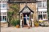 . Walk up Grindsbrook quite humorous
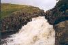
 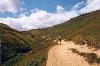 . Kinder bone dry, but it did pick with rain a tiny bit. Found Kinder Downfall
 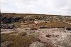 , but no water (first time I'd seen it). Found trig point. Bleaklow easy. Ended day ~8:30, somewhere on hillside overlooking Crowden
 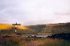 .
.
Day 2
Start ~9:05 End 18:44. 9h30' expected, 9h39' taken + extra walking along reservoir (20 mins).
The M61 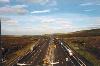
Climb up Black Hill 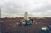 quite long. Went wrong way, did PW alternative (Wessenden
 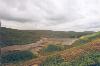 ) rather than undefined. I wish it would be definitively undefined. So pub at Blackstone Edge
 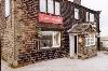 closed when we got there. Largely my fault. Were supposed to go to Lambutts or Mankinholes, but we'd had enough by the time we reached the White House
 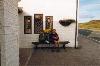 , which fortuitously opened a little early. So we ate, walked about a mile (maybe a tad more), camped on the water board moor, went back to the pub and Al ate some more
 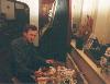 . I had a wash, but left my deodorant in the gents. Not the end of the world - it saves me carrying a little weight.
Day 3
Start ~8:55 End ~20:00. 10h15' expected, 11h05' taken.
A nice bit of stream 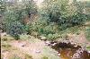
Gate going the wrong way, despite Penine Way marker 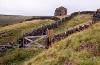
Since I had discovered pubs in Ickornshaw, it was decided to cut our losses and head for there. Stoodley Pike! Stoodley Pike! Stoodley Pike! We made it to the pub 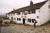 in time for a drink, but not food. Went past Withins
 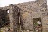 , supposed setting for Wuthering Heights. Last leg to Ickornshaw a real killer. Path (or so it seemed to me) took on a zig-zag consistency that bore no resemblence to that on the map. Pubbed again, both food and drink. I also had tea at May's farm, same place I conked out last time. Midday pub excellent!
Day 4
Start ~8:50 End ~19:00. 7h14' expected, 10h10' taken (+2.4 miles)
Alan takes a break 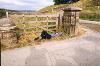
Small river not far from Malham 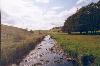
Rained all morning, which I found quite hard going. Pubbed (liquid and solid) midday East Marton. Things got better after that, and generally flatter. Rolled into Malham ~7:00. YH. Shower. Washed clothes. Pubbed (2 pubs!). Bed. Nasty YH sheet sleeping bag. Yorkshire Dales-ish day. Unmemorable scenery.
Day 5
Start Malham ~9:10 End ~19:20 (2hrs in Horton). 9h22' expected, 9h50' taken.
Malham limestone crag 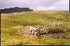
Al f*cked off back to Bridgend 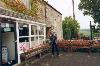 , too little money, too tired, needs to sign on on Monday. Blasted my way to Horton-in-Ribblesdale. Generally misty, some light rain. So didn't see Cove
 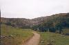 & Tarn to full effect. Did ~15 miles in ~6½ hrs, including 820 metres of climbing, so pretty much the equivalent of Day 1. Few people on Fountains Fell
  . Quite a lot on Pen-y-Ghent. Spent ~2hrs in the teashop in H-i-R, drinking tea, eating chocolate & fudge shortcake & beans on toast & milk and writing 6 postcards. Then 2 hrs up the path past Ling Gill, a nice little place though rather isolated.
Day 6
Start 8:27 (early) End ~18:20. 9h12' expected, 9h53' taken.
A fairly sleepless night. Too windy on the fells. Lots of rain. As I suspected, there's a bunk barn at Cam Farm, also refreshments. I was tempted, but it's about ½ mile off the path. Just too much and it was only ~9:30 when I got there. I only met 3 others coming my way that morning.
Hawes - v. touristy. 4 pubs, I visited 2. 1st for Marstons Ped, cheese sarnie & ½ of lemonade, then a Theakies pub (pub guide is now out of date). Bought a postcard. Phoned mum.
On to Hardraw. Phoned Stephanie. Pub there is Theakies (also wrong in pub guide). Long haul up 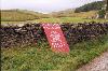 to Great Shunner Fell. Overcast, cool and windy. Way down OK except for 1km of track, horrendous, very stony and uneven. Has the hardness of tarmac, but completely random so twists the ankle. A real f*ck-off. There should be standards. Unfit for human ambulation. Down to Thwaite
 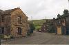 . Camped above Muker, ate a raven, something with potato. Descended for the pub. Theakies. OP good. Basket of chips not so good. Wrote a postcard to Elliot. That's all today.
Day 7
Start 8:53 End ~19:40. 10h17' expected, 10h47 taken.
Stream at the base of Tan Hill 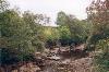
Slow start. Went a bit wrong and had to fight through the bracken 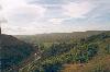 . Then followed a group not PWing for ¼ mile. Then did ASH/Countryside questionnaire. Am I a man or a statistic? Fairly slow up to Tan Hill
 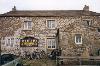 . There for 35 mins, free XB! + lemonade + cheese sandwich + postcard + 4 chocolates. Very fast to next stop, 5.4 miles in 2 hrs. Pretty fast to wherever it is that the YH is. Then it started to rain. Short leg to reservoir, bloke gave me some coffee. So there are some decent people in the world. Painful up/down session on way to Middleton. Camp site £1.75. Washed. Noticed nasty sores from rucsac straps. Right tendon still painful - gives nasty clicks when moved after walking.
Dosh. Start £95. Now £41. YH £7.
Expenditure so far 95-41=54/7=7.70ish
w/0 YH=47/7=6.70ish
so 7.7x6=46.20 too much!
6.70x6=40.20 v. close. Need more!
(Else: cut expenditure. Not easy)
Also: bloke who asked about son(s)
Day 8
Start ~8:50, but went to PO in Middleton so on path ~9:15 End Dufton YHA 18:11. 8h44' expected, 8h56' taken
Low Force 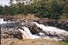
Along the Tees 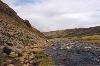
Charged £2 by PO to get some dosh. Oh well. Pretty dull along Tees. Lots of Stiles. High Force 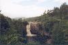 unexceptional. Decided not to bother with a pub - either close to the path but too early in day, or at right time but too far from path. Fortunately, I found a farm that did snacks/refreshments, about a mile after the turn to the last pub. Tea a real life saver. Cauldron Spout
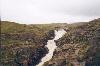
 impressive. Long, moor slog up to High Cup Nick
 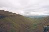 . 13th => grouse shooters out in force. Low flying Tornado, could hear air crackling after it went past, and a 2nd going right up the Nick. Belted down the track to Dufton, making up for a rather slow morning.
Day 9
No notes for start/end times or time taken. expected 9h03'
Long slog up the hill. PW confusion to start with. And a YH breakfast. 3 facts in completely the wrong order. MoD radio/EW whatsit on Great Dun Fell 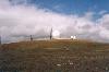 , or whatever it is called. Biggy before Cross Fell. Stony road for ages - a pain. Sign saying Carrigill open for refreshments, which it wasn't. Dull plod along banks to YH.
 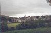 Couldn't resist staying there, right next to the path. Micro pub crawl (was in time for a hostel meal).
Day 10
No notes for start/end times or time taken. expected 8h58'
Bollocks dumb stupid PW. Pussyfooting main roads.
Crap waymarking. If I wanted to do a 21 mile session of map exercises, I'd take up f*cking orienteering. God help those poor bastard Ossies/Kiwis. They must have been right pissed off. I can understand why most people stick two fingers up to the 'offical' path and belt along the railway line. But it isn't a right of way. This makes today the worst so far. Dropped my compass in a field, but retrieved it. Schoolies & Mark asked me the way, which I wasn't sure of. Then they went the wrong way. And again later, they didn't follow me over the moor. A mild pleasure. Another downer - a small hole in my Gore-Tex o/trs when trying to climb over a fence because the path was nonexistent and totally unwaymarked. If the farmers want walkers to keep to paths they should f*cking properly mark them. Are they totally STUPID??
Day 11
Start 7:42 End 17:40? 7h42 expected, 10hrs taken.
Poor sleep after windy night. Hadrian's wall up and down. Difficult navigation to Wark forest. Forest fairly good. Rain rain rain. Tea & scone & jam at Horneystead farm. A lifesaver, but got coaldust everywhere. Met a couple of lads who've been PWing for 17 days or summat. (Andrew & Robert). A dull plod to Bellingham. Lively evening, after shower & food. Visited all 4 pubs. Had more food. In Hare & Hounds, long conversation between some Catholic woman & Andrew & Patrick. Got back to Hostel 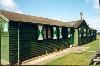 at 12, Bert climbed in through the window to let us in. Some bastard snored all night, at about 80dB, and in a horrible, irregular fashion. Silence with mough open. Quiet snore. Bloody loud, ear rending snore. Then mutter/fidget/speak at once. Then the silence again. And so on all night. I suggest segregation of snorers in hostels. I also had real smelly flatulence.
Day 12
Start 10:10 End 15:40. 6h48' expected, 5h30' taken wow!
Byrness (just about the whole village) 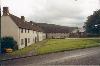
Lazy, slow morning. Bits of clothing still damp. Stocked up on chocolates. Speeded along, ½ hr break, speeded along again. Dull, purple heather moors. Forest. Yawn. No pubs/teas midday, ah. Walking in a group for a change. Me, Mark, Patrick, Andrew and Robert 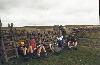 . They are all in Byrness YH, along with the two public school boys. Lengthy food at the cafe at the petrol station. Went uphill, after finding PO closed, pitched tent, cooked food (Raven)
 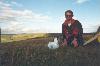 , came back down to pub for more food (3rd hot food of the day!). And here I am.
Day 13 The biggy
Start 6h55 End 17h15. 13h44' expected, 10h20' taken <- incredible.
Camped on top of the hill. A bit cold. Crawled out of bed and usual breakfast, dress, pack. Blind dog people passed as I was loading up. My secret weapon was an accidental detour (quicker) past Chew Green/Roman Camp. I was truly belting along. Peeped in the Mountain Rescue Hut. Got to the base of the Cheviot by 13h30. Views good, but not overwhelming. Weather slightly cloudy, but with long sunny spells. Dashed up & down the Cheviot w/o rucsac, left it with Mark/Andy/Bert who were resting. Things got a bit slower after that, but there were only 8 ½ miles to go, so no problem. Visited the 2nd mountain rescue hut. Long drag down, briefly intersperced with the climb at The Schil. Tarmac road 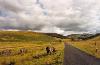 bliss to see for a change. Could almost see the 'you are here' dot on the map moving. One last little hill, then straight down into the Border Inn
  . Beer, food then off to the YH which was almost full. Dormitory full of Ventures with a collective IQ of 0 who thought farting the height of humour. They weren't that bad really. More drinks in the evening.
Some notes
Raven - dehydrated food for backpackers. Just add boiling water to the plastic bag, stir and leave to stand for a couple of minutes. Then you usually end up with something that tastes disgusting and is barely edible. I suspect that the cardboard wrapper and plastic bag are tastier and more nutritional than the alleged food.
YH - Youth Hostel
OP - Old Peculiar, a beer brewed by Theakstons (Theakies), who also brew XB. Not to be confused with PO, the Post Office.
Ped - more beer, this time Marston's Pedigree
2 weeks holiday for less than £200 may not seem much now, but it was then, especially to a student. And it doesn't help that you don't exactly find many a Midland Bank cash dispenser on Cross Fell, if you catch my drift.
Back to the present, 2001. Funny how the mind plays tricks on you. There are some things that I can very clearly remember, such as the barn (or was it coal bunker) in the rain where I had tea and scones served by two charming old ladies that couldn't have possibly made any profit with the low prices they charged. Or the fort on Hadrians Wall in the sunset (and the very disappointing picture when it came out). Or getting into the shower at Dufton Youth Hostel, and being so tired that I couldn't stand up to wash myself, so I just sat down and did it.
On the other hand, some of the above passages could just as well have been written by a stranger. I've no recollection of any antipodeans I met on the section before Twice Brewed.
Legal
Copyright © Paul John Floyd 2002
